Posts

THE SNAPSHOT OF BREP

Image
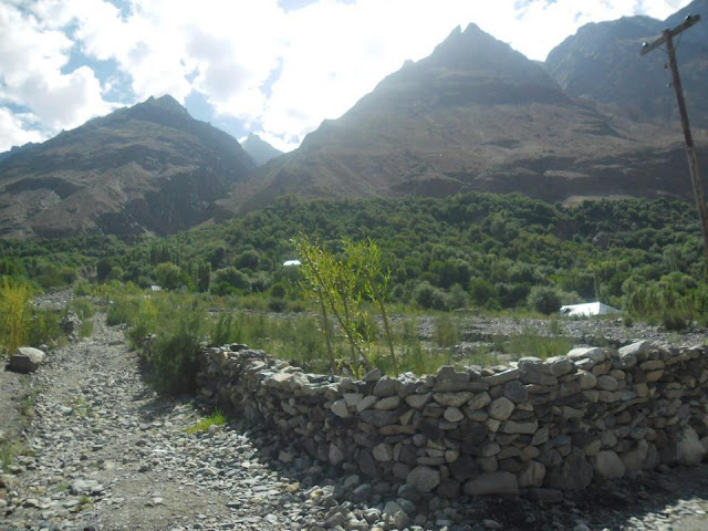
It is one of the biggest villages of Mastuj region. About 30 Km away from Mastuj it stretched left alongside of Yarkhoon river. There are many small partitions and these partitions assigned with different names i.e Naso Koch, Ratheni, Jam Lasht etc. Yarkhun Road passes through this village. It is a center of Schools/ Colleges, Health Centers and fair Markets. Common fresh fruits available here. 

MADAK LASHT

Image
The most beautiful and attractive vally of Chitral Madak Lasht not only having rich natural resources and forest , but also having a unique culture These people came from Tajikistan and Badakhshan in 1700 AD and settled in this valley. Their ancestor made weapons from iron and the ruler of Chitral invited them for this purpose. They speak Persian as well as Khowar and follow the customs and habits of the Khow people. However, some of their culture is still preserved and their language, is still spoken in Madaklasht. Thus, they have preserved their individuality while mixing with the Khow society. Madaklasht is famous for its cold and pure water rich forest and different kind of fruits.

I S T A C H

Image
A small village (containing  86 houses and 639 people, houses built by mud, stones and wooden roof over them) is called Istach. It is 25 km away eastward from Mastuj and about 136 km away from Chitral. Lush fields full of wheat, maize and other crops bordered by attractive green grass. Different verities of fruit i.e apple, grapes, peach pear. mulberries are available here. People are very simple and good. Two schools Primary (for boys) and Middle (for girls) built by Government, and a community based Primary school (English Medium) started by the villagers. No hospital or dispensary available here. The unpopulated deserts "Khotanlasht" stretched in eastward and "Scienogh" is in southward. There are dry high mountains in north, north west and western side. The villagers are suffering from the shortage of irrigating water because there is no glacier or spring water on the mountains. In cold season when snow falls, it remains freeze on the top of the mountains the...

Chitrali Traditional House

Image
The traditional Chitrali house called 'Baipash'. It has 6 strong pillars supporting the entire structure. The design of the house is so strong that it can stand even if walls around it will be taken away. The structure is quite skillfully adapted to the seismic condition of the Chitral valley, which is traditional receives more shocks of earthquake. The house has a hole (Kumal) right on the roof to let the smoke out and daylight in. It has hearth at the center where women cook food and all the people in the house get around the fire to get heat in winter. There are two sleeping place on both side and wood storage near the entrance.

MASTUJ

Image
From Booni the paved road degenerates into a jeep track and continues eastwards up the Mastuj Valley, revealing awesome views of Booni Zom. Parwak could serve as a base to explore the glacial valleys spilling down from the Buni massif. The village of Mastuj (2400m) is three hours (110km) from Chitral town along a very rough 4km side road. It’s a good base to break the journey between Chitral and Gilgit, and you could easily lose time doing some lovely day walks in the fields and side valleys here, always under the snowy gaze of Tirich Mir.If you belong to other country then you must sign in with the police (at the bottom of the bazaar). Until 1880, Mastuj was the ‘capital’ of the Khushwakht stretching eastwards into Ghizar. A British garrison confined here during the 1895 siege was rescued by the column that crossed the Shandur Pass. The old royal fort stands next to the Hindu Kush Heights Hotel. From the south, Laspur Gol enters Yarkhun Gol. Up this canyon are the villages of Kosht...

A little about Chitral

Image
Little is known of the early history of Chitral and rock inscriptions and early traditions give little evidence on this subject. This mountainous country which was first referred to as Kohistan or land of the mountains was said to be inhabited by a race called "Khows" speaking a separate language Khowar, or language of the Khows. Some people say that it was Khowistan - the abode of the Khows. Separate parts of the country came to be called Torkhow - Upper Khow, Mulkhow - Lower Khow, names which persist to the present day. An early Sanskrit inscription at a village called Barenis (27 miles away from Chitral) of about AD 900 records that the country was Buddhist, under King Jaipal of Kabul. It is believed that Upper Chitral was under Buddhist influence in the past and even today there are a few rocks in Torkhow area known as "Kalandar-i-Bohtni" (Mendicant of Stone). It is a figure of a stupa; the upper part of which has been cut into the figure of Buddha and may be ...

Introduction to Chitral

Image
Chitral is undoubtedly the most romantic, captivating and enchanting place in the majestic Hindukush range. It is a mountainous area in the extreme north of Pakistan. The landscape of Chitral is extremely mysterious with its steep harsh mountains, lush green valleys, beautiful meadows and big glaciers which have made it one of the most difficult and inaccessible areas of the world. Chitral is divided into small valleys by the mighty Hindukush range. The highest peak in this range is Terichmir, which lies at a height of 25,263 feet, just 36 miles away from Chitral town. It is also called the palace of fairies. No mountain in the region is less than 4,000 feet and over 40 peaks have an altitude of 20,000 ft.Chitral is surrounded by the Wakhan, Badkhshan, Asmar and Nooristan provinces of Afghanistan in the north, west and south-west. On its southern boundary lies the upper district of Dir, while in the east is Gilgit-Baltistan and in the southeast the valley of Swat and Kohistan dist...